
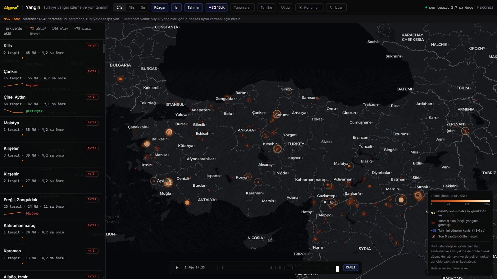
Seeing a wildfire start from space is possible — but how fast, how certain and within what limits is rarely discussed honestly. Building the Algow Yangın map forced us to measure all of it. What follows are not marketing claims but numbers from our own data.
Which satellites see fires?
Two very different satellite families cover Turkey, doing two different jobs.
Polar-orbiting satellites circle roughly 800 km up on a north-south path, passing over every point a few times a day as the Earth turns beneath them. Five matter for fire detection: Suomi-NPP, NOAA-20 and NOAA-21 carrying the VIIRS sensor, plus Terra and Aqua carrying MODIS. The key difference is resolution: VIIRS resolves 375 metres per pixel while MODIS resolves 1 kilometre. VIIRS therefore looks about seven times sharper and is far more likely to catch a small fire.
Geostationary satellites sit 36,000 km above the equator, turning with the Earth so they appear fixed in the sky. Europe's Meteosat is one, and because it stares at the same hemisphere continuously it scans every fifteen minutes. The trade-off is a much coarser pixel covering several kilometres — but the timing advantage is invaluable.
They are complements, not competitors: polar orbiters tell you where precisely, Meteosat tells you when frequently.
How late does the data arrive?
A common misconception: the image does not reach your screen the moment the satellite captures it. It must be downlinked to a ground station, processed and distributed.
Our measurements: detections from polar-orbiting satellites reach us between one and eight hours later, typically two to four. Meteosat data arrives in about thirty-five minutes. On top of that sits the question of when the satellite passed at all — gaps between passes can leave blind windows of up to five hours. A fire that starts at night and is extinguished before dawn can fall entirely inside one and never appear.
That is precisely why we added Meteosat: fifteen-minute scanning collapses that five-hour gap into roughly half an hour.
How small a fire can be detected?
Sensors see heat, not flame, so the question is not how many square metres are burning but how much energy leaves that pixel. In practice, within a 375-metre VIIRS pixel, a hot enough fire of roughly 50 to 100 square metres becomes detectable. A garden bonfire stays invisible; half an acre burning in earnest does not.
But detection is never guaranteed. A fire stays invisible when cloud cover blocks infrared radiation, when tree canopy shields heat spreading beneath it, or when timing works against it and crews put the fire out before any satellite passes.
The reverse error matters just as much: because satellites see heat, not every dot is a fire. Refinery flares, gas burn-off, power plants, steel and cement works and post-harvest stubble burning all register as detections. A dot appearing at the same coordinates every single day is the clearest sign of a permanent heat source rather than a fire.
Does it actually work? We checked against the news
Rather than assume, we tested. We compared fires reported in the news that day against detections on our map.
Fires at Çine in Aydın, Yeşilüzümlü in Fethiye, the Gömeç-Burhaniye corridor in Balıkesir and Gülnar in Mersin all appeared at the right coordinates and the right times; the largest was captured with more than three hundred separate detections.
Yet the same night, fires near Dikili and Çandarlı in İzmir produced zero detections. They were small, started at night and were extinguished between passes. That is the system's honest limit and worth stating plainly: reliable for large, ongoing fires; blind to small, quickly extinguished ones. The absence of a dot never proves the absence of fire.
Can we predict where a fire will go?
This is the most misunderstood part. Saying "the fire will move that way" from wind data looks easy, and we did draw a cone showing where wind is carrying. Then we back-tested it against our own history: we measured where fires actually spread and asked how well the cone knew.
The result was unambiguous — the wind-based forecast was no better than chance at predicting observed spread. The reasons make sense: crews attack precisely the advancing head of the fire, flames climb slopes regardless of wind in mountainous terrain, and wind turns between satellite passes.
So we present the cone as "wind is currently carrying this way", never as prophecy. What is genuinely reliable on the map is the track the fire actually followed across passes: where it started, how fast and in which direction it moved. When observation and wind disagree, trust the observation.
Where can anyone get this data?
All of it is public science: fire detections via NASA FIRMS, the Meteosat product via EUMETSAT LSA SAF, weather via Open-Meteo, burnt area perimeters via Copernicus EFFIS — all free. Technically anyone can build this map; the hard part is not accessing data but presenting it clearly and honestly.
That is why Algow Yangın is free and open source: no ads, no user data collected, source code open to all. Open the map at yangin.algow.net, or build on top of it in your own project.
Most importantly: this is not an early warning system. Fires are still spotted first by watchtowers and people on the ground. If you see a fire in Turkey, do not wait — call 112 for emergencies or 177 to report a forest fire.